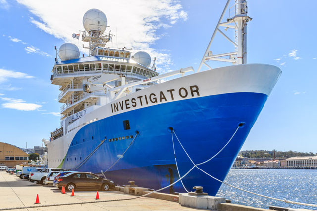
Once past the security gate, we drove into the Marine National Facility’s carpark – debatably the carpark with the best view in town. The immense vessel towered above us, looking new and proud in her white, blue and green paint job.
For the next two weeks we would be boarding this ship several times, navigating a maze of corridors on multiple levels, pushing through heavy doors, climbing steep flights of stairs, swaying slightly as we walked on the windier days, and when we were outside, stopping briefly now and then to look out at the spectacular view of the Hobart waterfront.
From the depths of the drop keel to the heights of the monkey island, our trusty camera equipment and highly advanced planning clipboard accompanied us. Many dangers lurked on the ship – some areas (near radar systems, especially) had to be isolated for us not to become “fried chicken.” Temperatures varied too – a couple of panoramas were taken in a freezer, and another in a rather warm IT storage room.
By the end of the photography period, we had taken over 2,500 photographs, making up around 200 panoramas of 9 ship levels. During the production period, our main computer was using up to 25 GB of RAM at a time to build the virtual tour. There were 68 information boxes, an array of simplified deck plans and other interface graphics to create – all of which had to be optimised to view on any device from an iPhone 4 to a 27″ monitor.
This was our biggest project yet, and although it had many challenges it was a fantastic experience. We breathed a sigh of happy relief when the project was officially signed off and a single flash drive containing the finished tour was hand-delivered to the CSIRO. We hope the maritime enthusiasts and science-minded individuals of our community and beyond enjoy exploring the Investigator as much as we did.
For any virtual tour inclinations you may have, small or colossal, scientific or otherwise, get in touch with us!

